• Skip to primary navigation
  • Skip to main content
The Centre for Active Transportation logo

The Centre for Active Transportation

  • About
  • News
  • Resources
  • Projects
  • Services
  • Connect
    • Subscribe
    • Volunteer
    • Donate

Active Transportation Planning Beyond the Greenbelt | March 2017


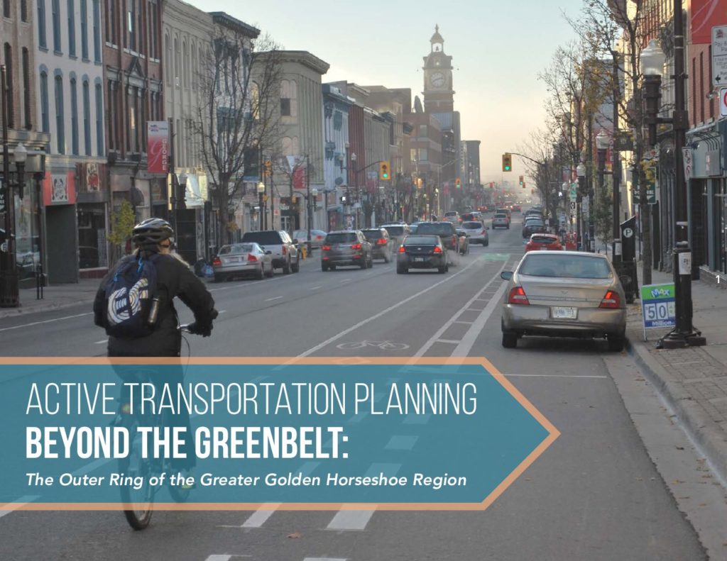
Active Transportation Planning Beyond the Greenbelt: The Outer Ring of the Greater Golden Horseshoe Region is a book that profiles 13 projects that have improved conditions for walking and cycling in unique contexts beyond the Greater Toronto and Hamilton Area.

The Greater Golden Horseshoe Region is bifurcated by the Greenbelt, a broad band of permanently protected land. The Inner Ring, the most densely populated and urbanized section, is on one side of the Greenbelt, and the Outer Ring, comprised of more rural and smaller communities, is on the other side.

The book profiles 13 Outer Ring active transportation project examples in three different contexts:

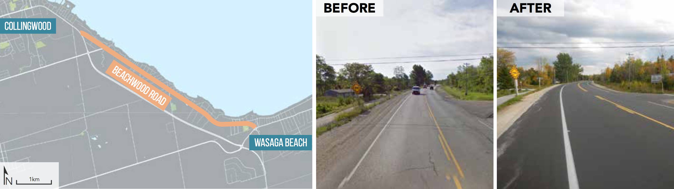
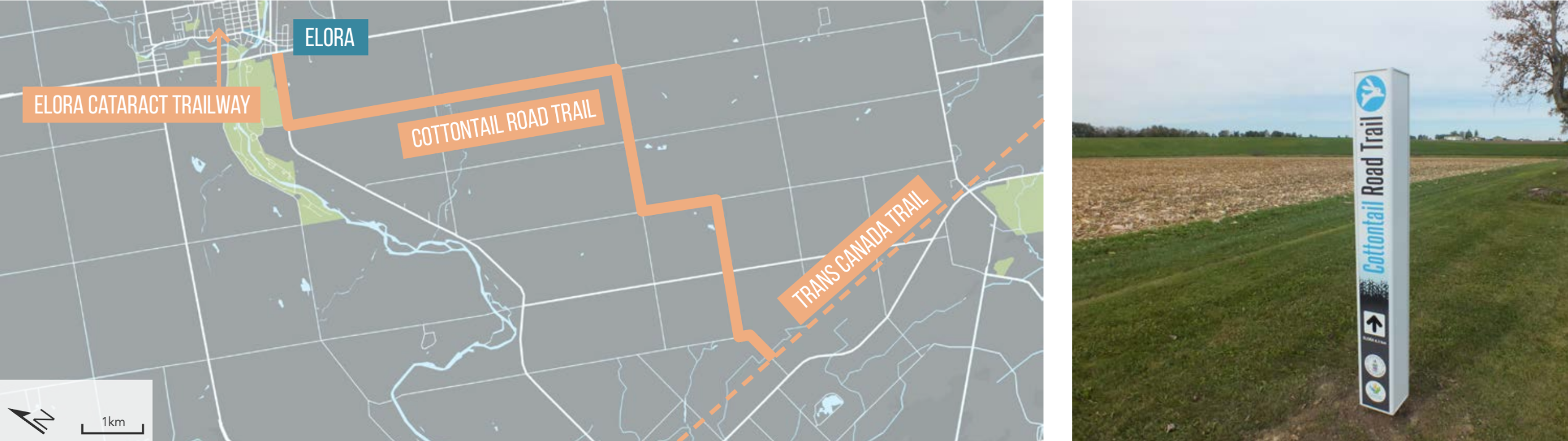
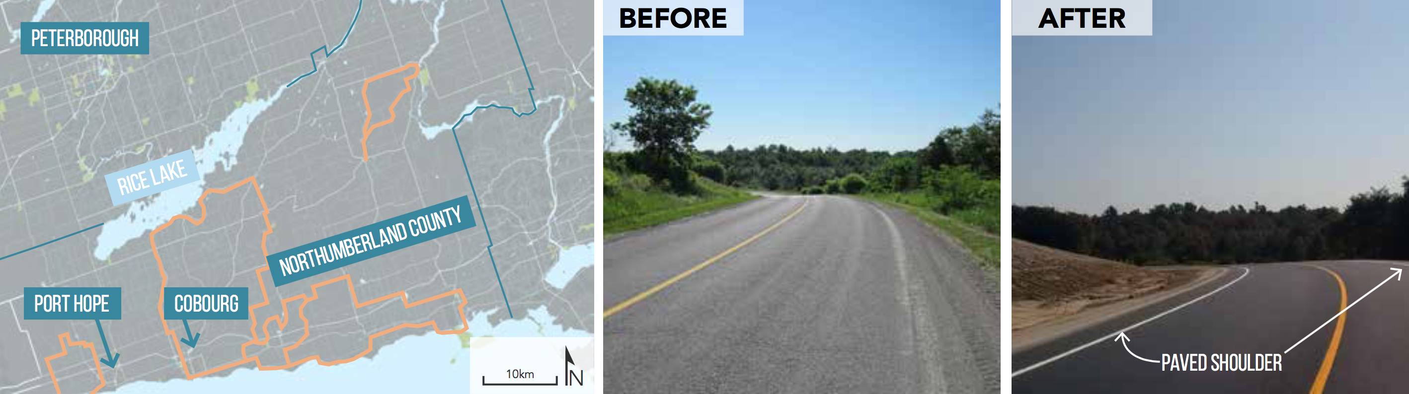
  1. Rural: Wellington, Northumberland and Simcoe Counties,
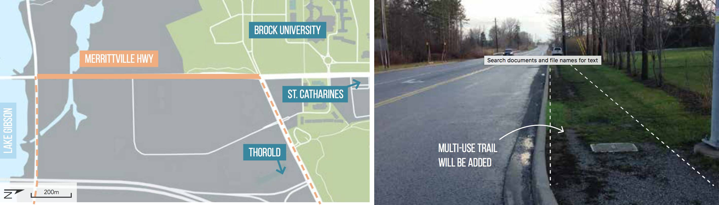
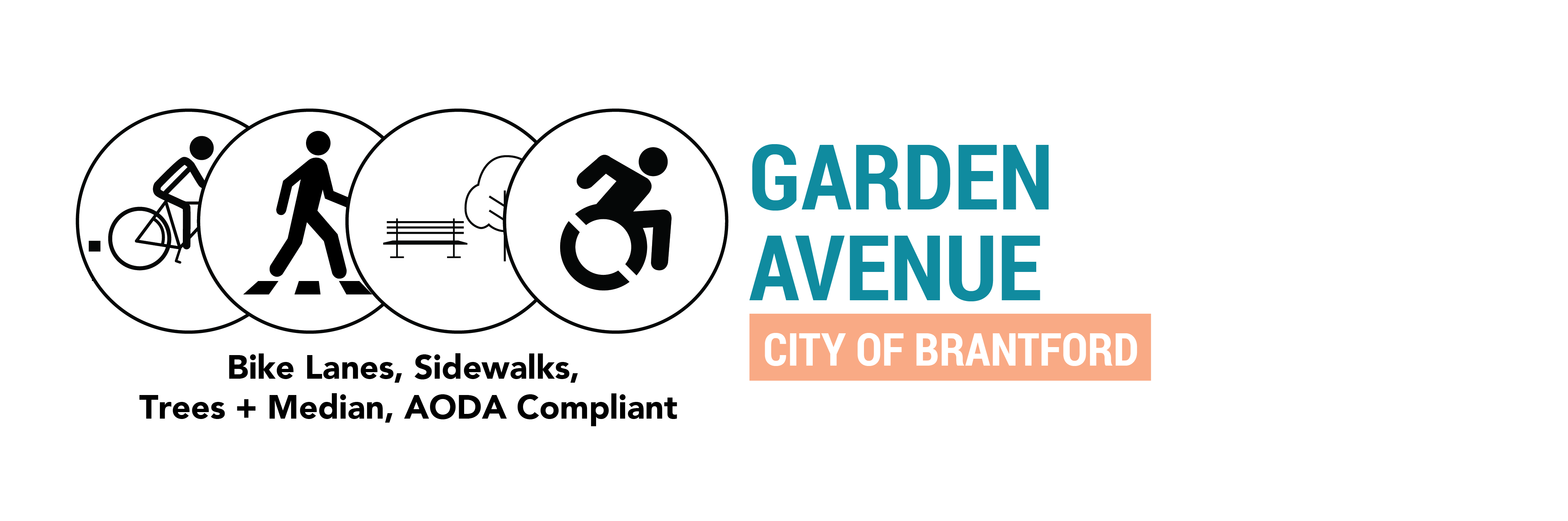
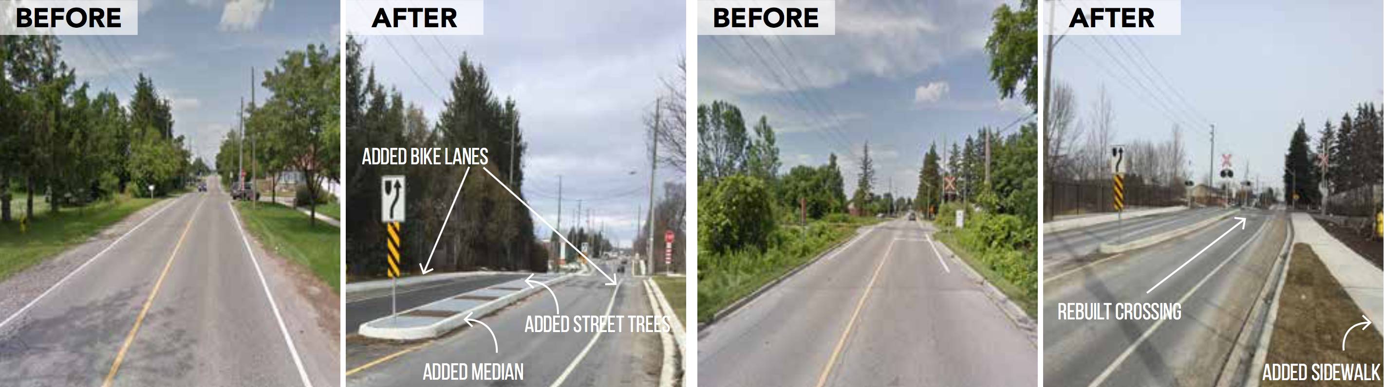
  2. Suburban: Brantford, Barrie, Cambridge, Orillia, and the Region of Niagara, and
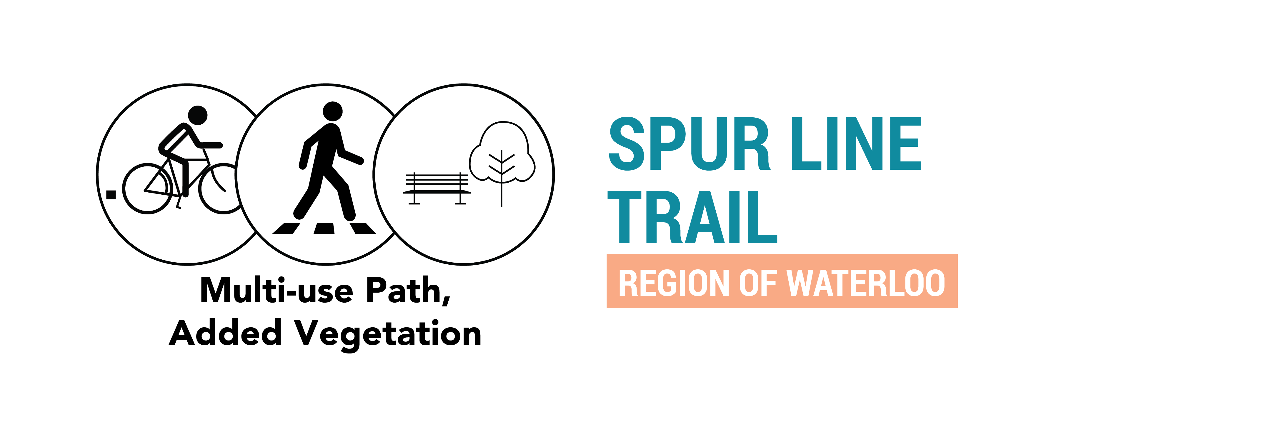
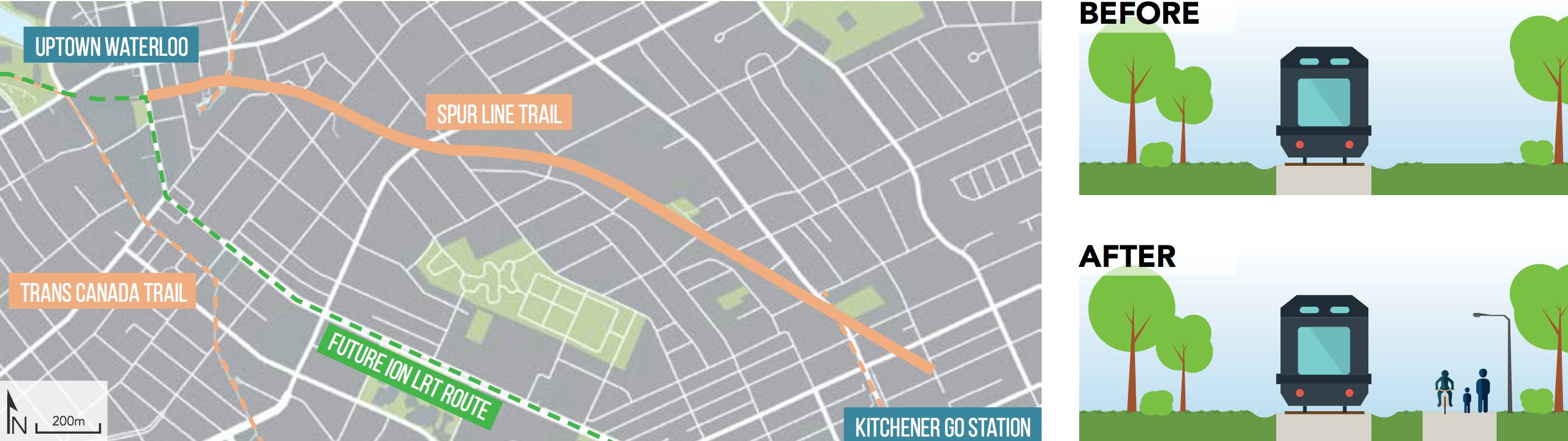
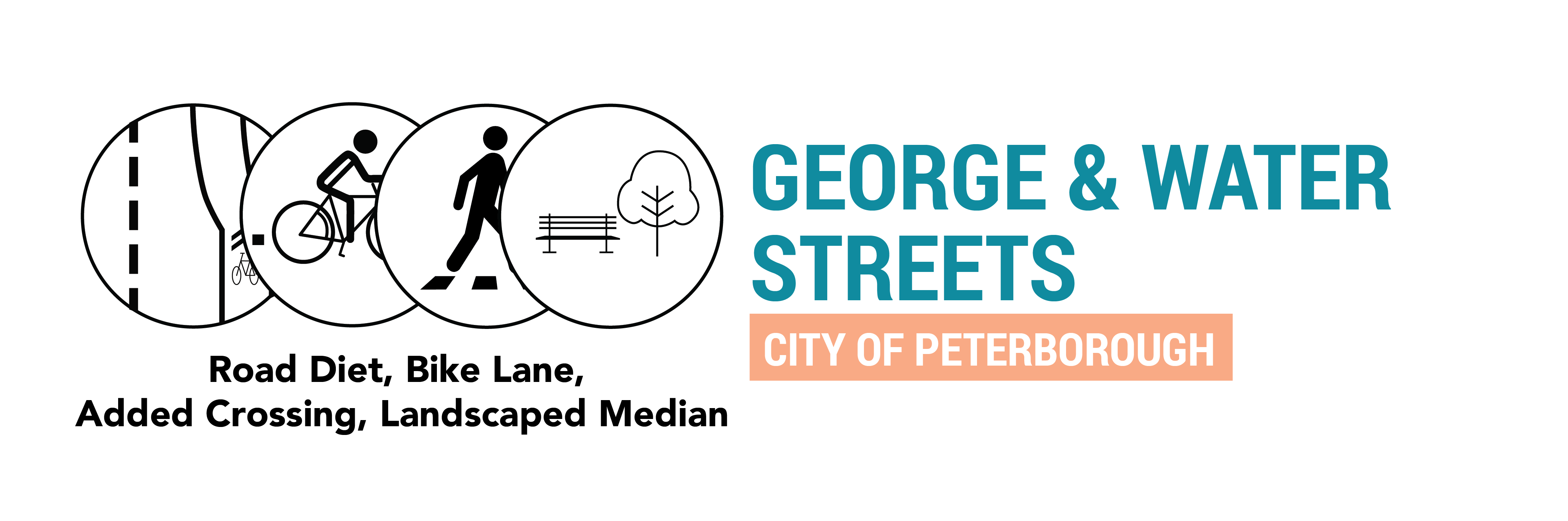
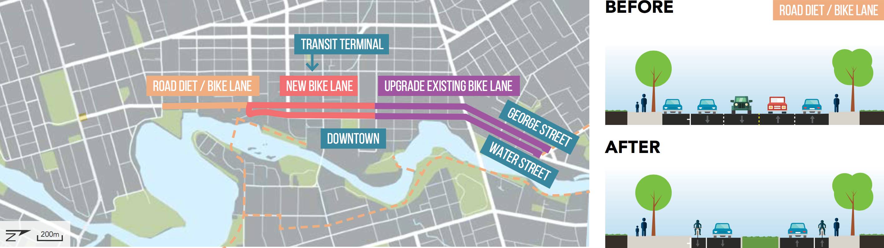
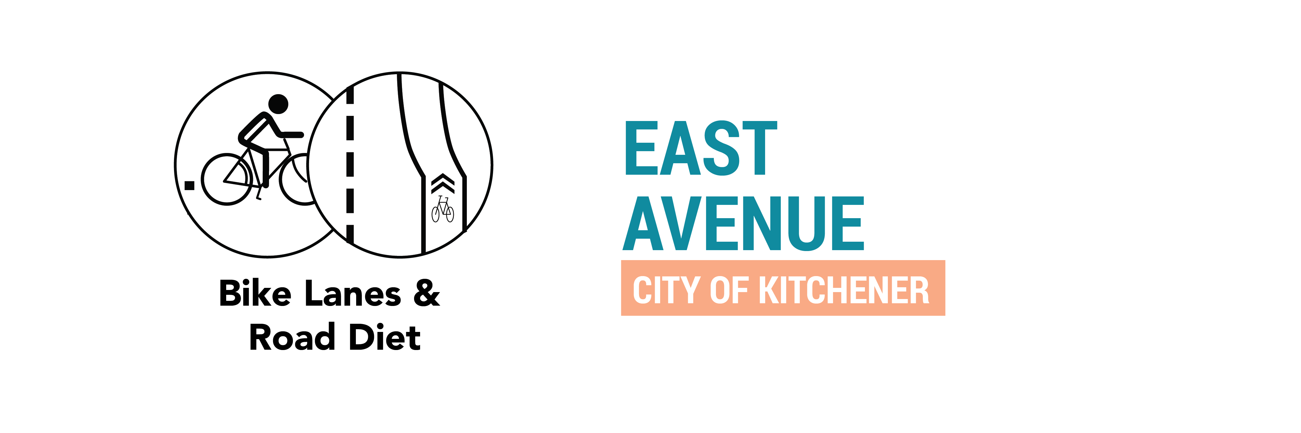
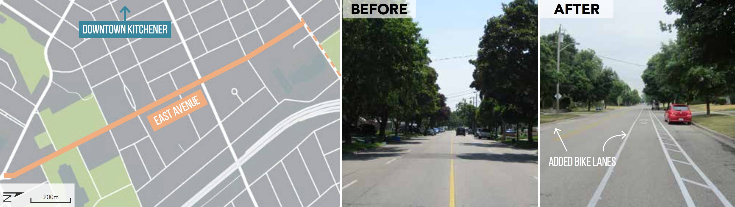
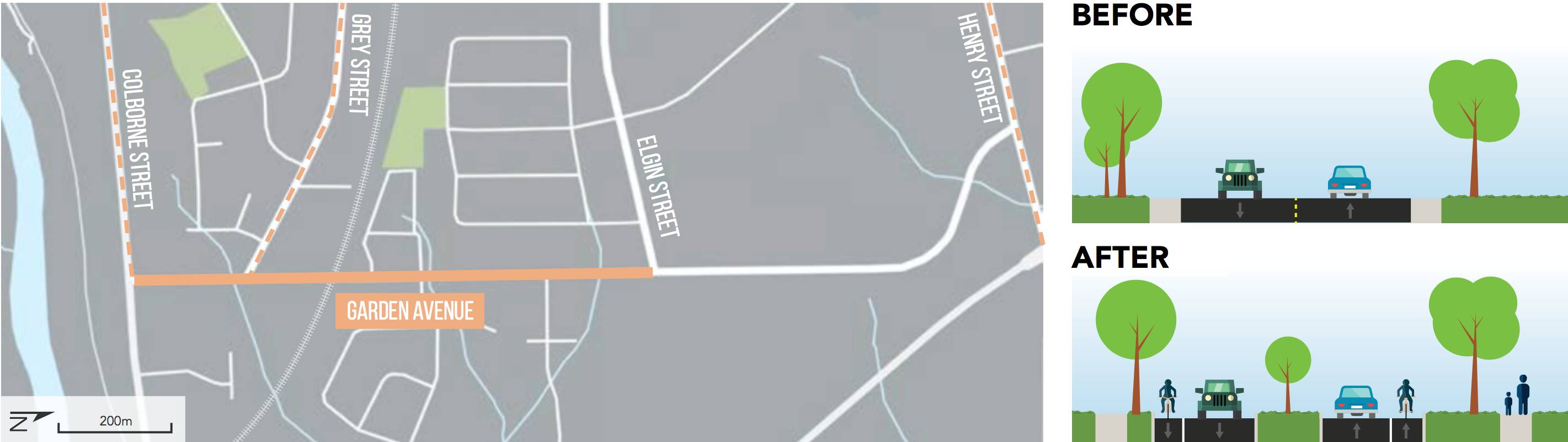
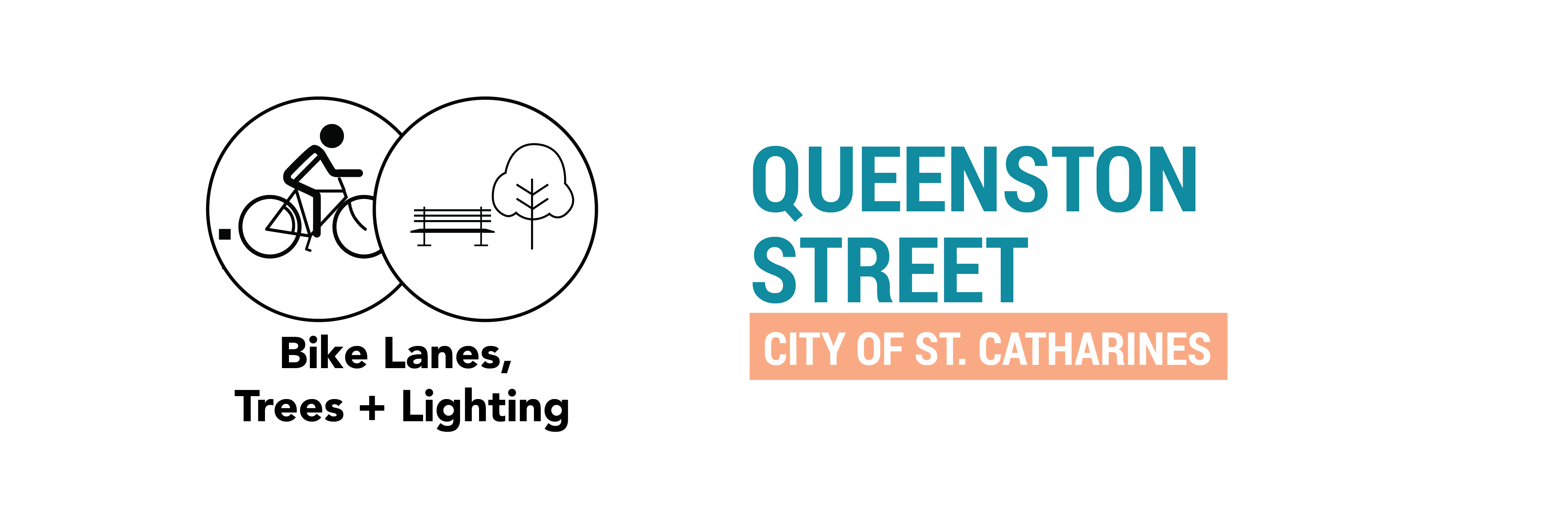
  3. Urban: Guelph, Peterborough, Kitchener, St. Catharines, and the Region of Waterloo.

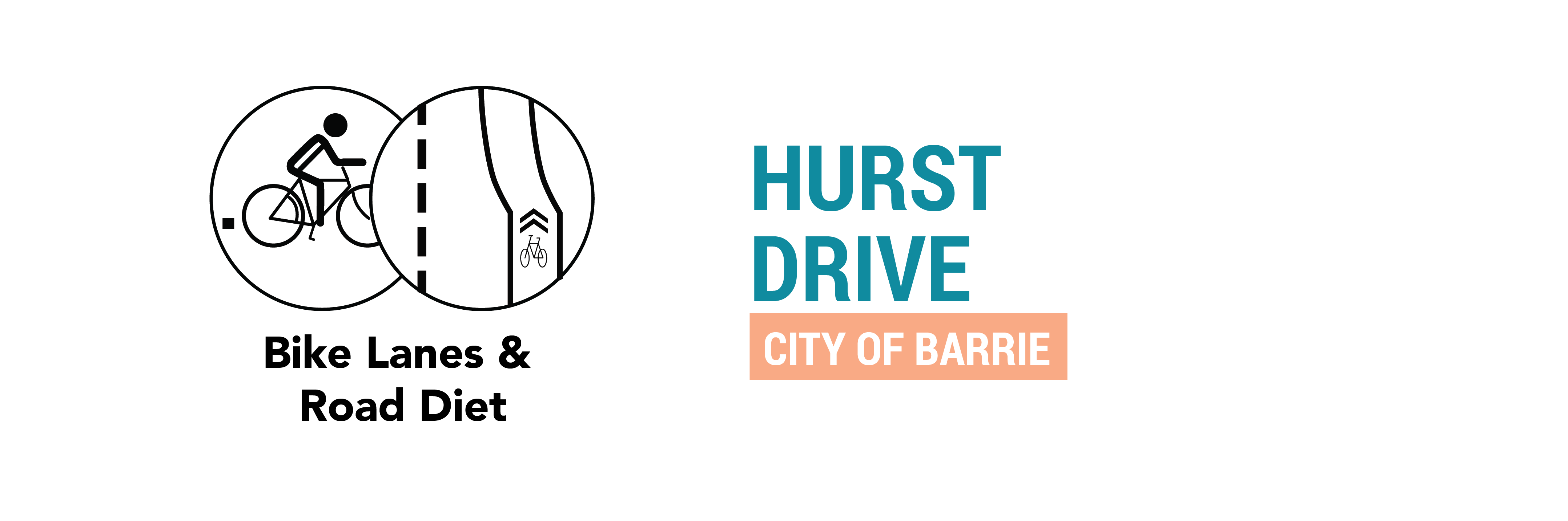
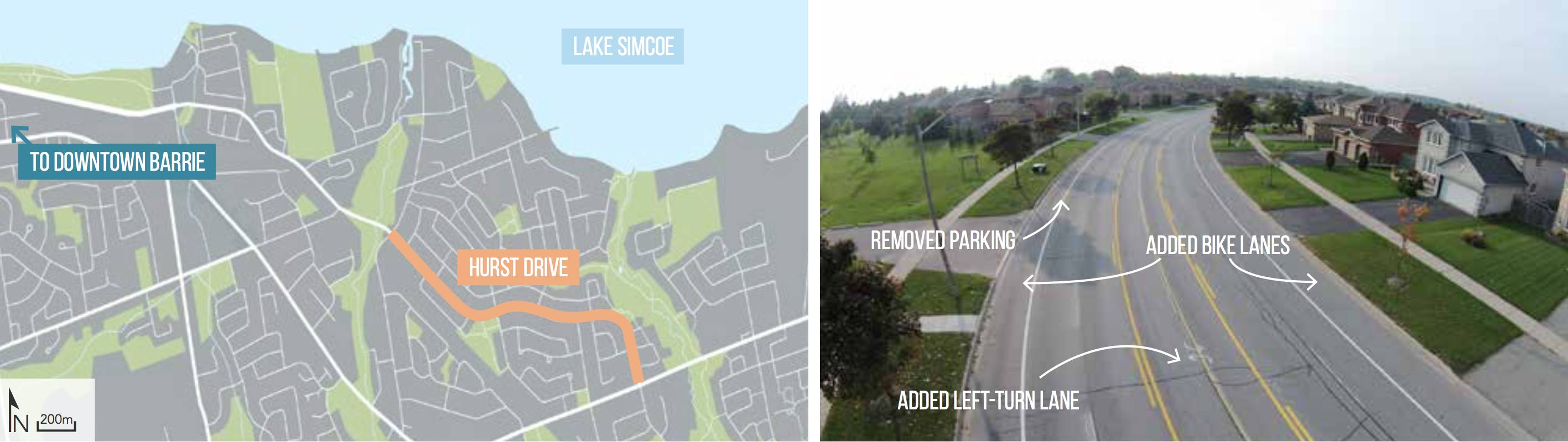
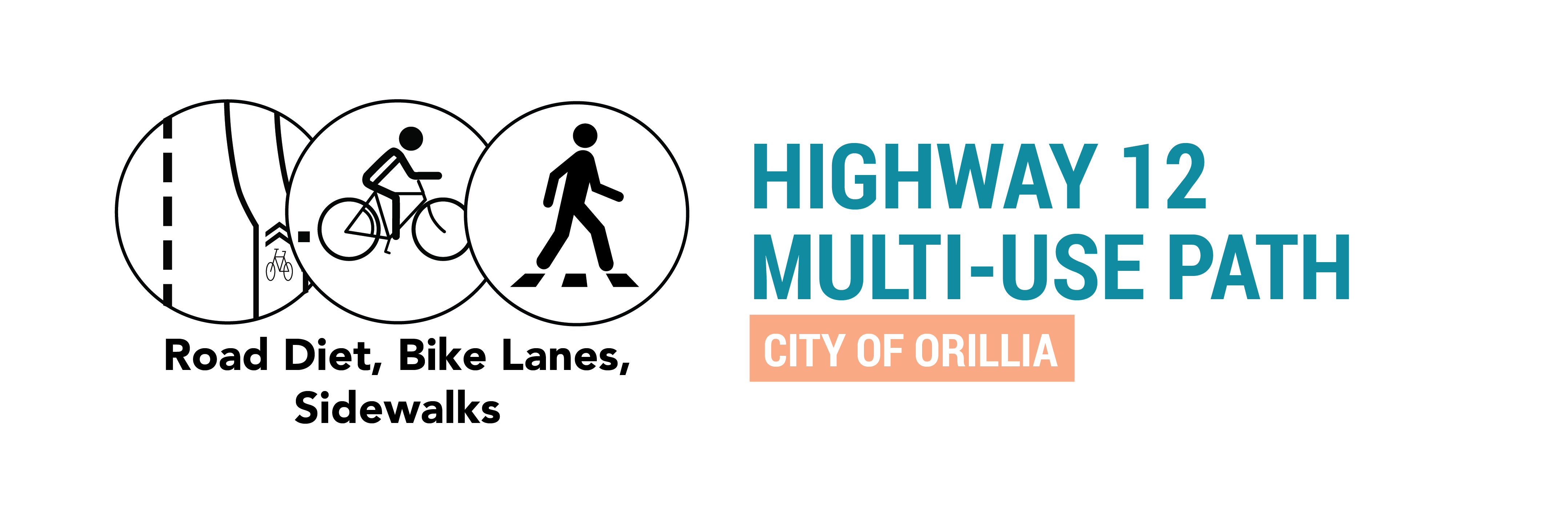
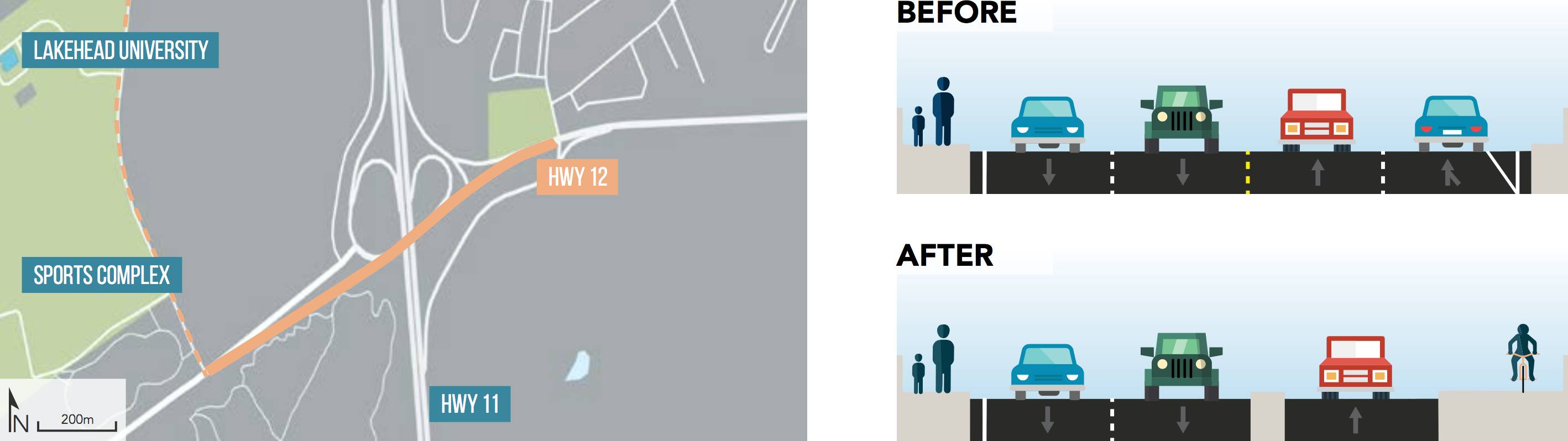
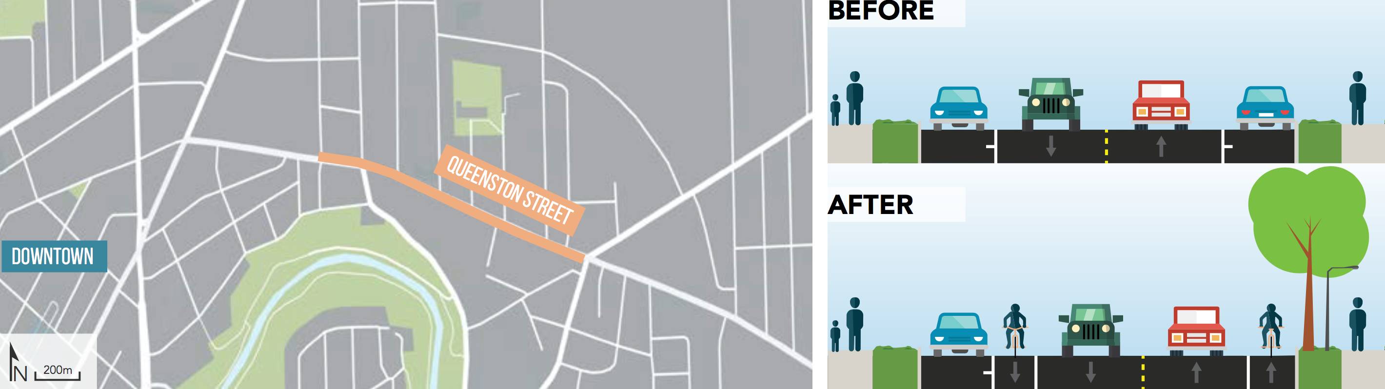
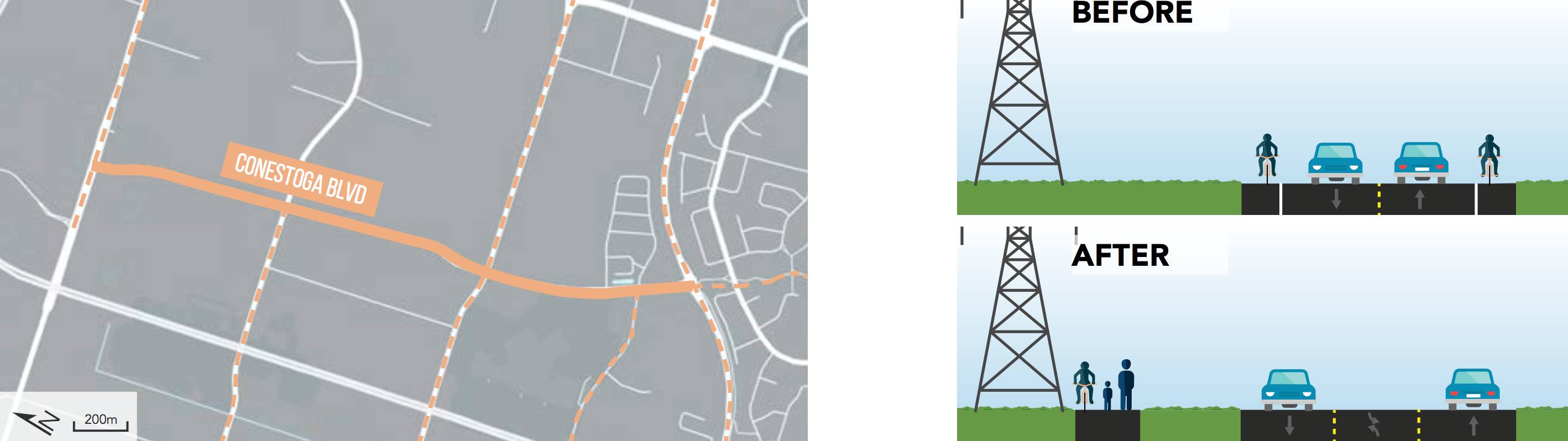
These 13 projects are wide-ranging and at times unexpected, as smaller towns, suburbs, and rural areas often face the perception that walking or cycling are not viable travel options there.  Physical conditions such as topography and large distances can act as barriers, as do the presence of provincial highways that run right through the middle of historic small towns. Despite these and other challenges, the municipalities in this book have successfully implemented off-road trails, paved shoulders, bike lanes, sidewalks and more to create spaces that encourage active transportation.

This book is a joint project between the TCAT, Ryerson University, and the University of Toronto, with funding from the Government of Ontario through the Places to Grow Implementation Fund.

This research builds on TCAT’s previous reports on Theme of Understanding Complete Streets in the Greater Golden Horseshoe Region: Complete Street Transformations, Complete Streets Catalogue, and Complete Streets Evaluation.

You can explore some of our case studies, or download the PDF file below:

Spur Line Trail: Region of Waterloo, ON

The Spur Line Trail is located in the Region of Waterloo and is a 2.4 km long off-road multi- use trail that runs adjacent to an active rail corridor and connects Uptown Waterloo with Downtown Kitchener and the Kitchener GO Station. Although only a limited number of trains operate at night at slow speeds, the rail corridor was the guiding force in the design and implementation of the multi-use trail.
The space adjacent to the rail line had been used informally as a connection through town. Funding from Metrolinx enabled the Region
to develop a formal, high-quality pathway that allowed more users to pass along it comfortably and conveniently.

George & Water Streets: City of Peterborough, ON

George Street and Water Street in Peterborough are the two main north-south one-way streets running through downtown Peterborough. The bike lanes’ northern terminus connects to the Rotary Greenway Trail, while at the south they end adjacent to trails along the waterfront.

Beachwood Road: Simcoe County, ON

Formerly under provincial authority, Beachwood Road was downloaded to the Towns of Collingwood and Wasaga Beach after a bypass route was constructed. Beachwood Road is a strategic link and now the safest route for cyclists between the two towns.

Merrittville Highway: Region of Niagara, ON

The Region of Niagara is building a multi-use path along an existing stretch of the Merrittville Highway which features significant and growing traffic for students travelling to and from Brock University. The path will link into existing and proposed paths at each end, contributing to a network of off-road cycling and pedestrian infrastructure in this developing district on the fringes of St. Catharines.

Hurst Drive: Barrie, ON

Hurst Drive connects the southeast end of Barrie to the Waterfront and is considered a major thoroughfare for the city. The project stretches from Big Bay Point to Cox Mill Road along Hurst Drive and adds an important cycling connection by reducing traffic speeds, adding painted bike lanes to both sides of the road, and undergoing a road diet from four lanes to two lanes with a centre turn lane.


Highway 12 Multi-use Path: City of Orillia, ON

The redevelopment of the interchange between Highways 11 and 12 in Orillia paved the way for an active transportation component on the east-west overpass. The bike lane will be the only strong cycling connection to the west side of Orillia, which is experiencing growth and contains both the West Orillia Sports Complex and a campus for Lakehead University.

East Avenue; City of Kitchener, ON

The City of Kitchener implemented a bike lane and road diet along East Avenue from Borden Avenue to Frederick Street, which had an existing bike lane. East Avenue is serviced by a local bus route, multiple schools, and parkland which provides strong connections for cyclists.

Garden Avenue: City of Brantford, ON

Located at the edge of Brantford’s urban area, improvements along Garden Avenue from Colborne Street to Elgin Street were implemented to improve safety, calm traffic, enhance the public realm, and enable active transportation access. Painted bike lanes and sidewalks were installed on either side of two vehicular traffic lanes. Median islands with street trees were added at every intersection.


Urban Trail Upgrades: City of Guelph, ON

The Guelph Cycling Master Plan was developed in 2012 with the goal of shifting mode share towards cycling and away from driving. However, as the infrastructure was built (nearly 50% complete), planners found they were not getting the ridership they were expecting. Surveys of residents showed a large “interested but concerned” faction that would not commute by bike unless it was on protected, off-road trails.

Some upgrades have already occurred, using information from the draft policy. These upgrades allow safe passage for pedestrians and cyclists through peaceful environments separated from automobile traffic. Winter maintenance will also be streamlined, as the GATNS policy will identify opportunities to review coordination between public right-of-way and trails networks in order to improve the effectiveness of the overall network. Design guidelines have been developed to address unique features and environments such as wetlands, parklands and boulevards.

Cottontail Road Trail: Wellington County, ON

The Cottontail Road Trail is a mostly off-road trail that now runs 14km in its entirety through the pastoral landscape of rural Wellington County. The trail represents the completion of the Trans Canada Trail through the county and connects two other major trails: The Kissing Bridge Trailway and Elora Cataract Trailway.


Queenston Street: City of St. Catharines, ON

Queenston Street is an arterial road in St. Catharines and a major conduit into the downtown area. The City rebuilt the road to include bike lanes on either side while removing half of the on-street parking. Landscape elements were also added, including lighting and street trees along this site of a large former hospital and major redevelopment area.

County Cycling Network: Northumberland County, ON

Northumberland County is improving conditions for cyclists through a program of rural road shoulder-paving. This project is a unique example of economic development through increased tourism being used as a main driver of an active transportation project.

Conestoga Boulevard: City of Cambridge, ON

Conestoga Boulevard is a major road running through an industrial area in Cambridge. The road had had a painted bike lane for many years. When it was determined left-turn lanes would be added to Conestoga and the bike lanes would need to be removed, the City decided to upgrade the bike lane to an off-street multi-use path for cyclists and pedestrians.

Purchase a hard copy of the book!

We also have a limited number of print copies of Active Transportation Planning Beyond the Greenbelt available. Choose your shipping location and click on “Buy Now” to purchase a copy. Please contact  tcat@cleanairpartnership.org for orders outside of Canada/USA, or for bulk purchases.


Shipping options


Active Transportation Planning Beyond the Greenbelt

Facebook  Twitter  Linkedin 
Subscribe

The Centre for Active Transportation

a project of
Clean Air Partnership Logo